About Stream Gauges Map
Approximately 5,000 of the 6,900 U.S. Geological Survey sampling stations are equipped with telemetry to transmit data on streamflow, temperature, and other parameters back to a data base for real-time viewing via the...
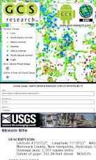
Approximately 5,000 of the 6,900 U.S. Geological Survey sampling stations are equipped with telemetry to transmit data on streamflow, temperature, and other parameters back to a data base for real-time viewing via the World Wide Web. A map of the realtime stations is produced every day. This map service pulls from the US Geological Survey throughout the day. To find out more information, or, to retrieve data directory, see the water watch web site at: http://waterwatch.usgs.gov/.GCS Research created the Google Android Stream Gauges smartphone App. Please visit us at: www.gcs-research.com.Esri ArcGIS Online provides web services. The App is built with the ArcGIS Runtime SDK for Android.USGS provides the data.GCS Research provides our clients with advanced geospatial information technology, so they can achieve their strategic objectives. We deliver internationally recognized, award-winning solutions through an innovative commitment to the customer’s concept and project requirements. Building upon exceptional service and affordable, industry-leading tools, our success is measured by meeting and exceeding the exacting requirements of our customers.Our portfolio consists of connected "smart" applications and data systems, innovative extensions for industry-leading core platforms, and extensible, integrated Web services. We utilize a standards-based approach to propel next-generation advancements along leading software packages and data resources and help our customers achieve their objectives through a combination of experience, innovation, and commitment to excellence. By building upon the software and data technologies of our strategic partners in the industry, GCS Research cultivates end-to-end geospatial solutions at the height of GIS evolution. Using Service-Oriented Architecture (SOA) and Web service protocols, our clients easily access and share geographic and related content across distributed networks, removing historical barriers to decision-making, analysis, and collaboration. GCS clients include a blend of commercial and government organizations. We deliver a diverse range of geospatial applications, advanced research and development activities, and strategic consulting services. GCS focuses upon the communication, analysis, and exploitation of geospatial intelligence for a dynamic, high-performance user experience. Our success is measured by meeting and exceeding the exacting requirements of our customers.GCS solutions consist of connected "smart" applications and data systems, progressive extensions for industry leading core platforms, and extensible, integrated Web services. We deliver intelligent human interfaces for geospatial analysis, simplifying access and control of scattered geographical information to a diverse client base.GCS Research provides a full spectrum of award-winning geospatial information technology services. We specialize in distributed geospatial analytics and provide integrated solutions for a variety of customers. GCS Research develops “bottom-up†custom applications and integrates systems focusing upon the end-user experience and workflow requirements. We combine a variety of technologies to deliver solutions tailored to each customer. GCS Research is a pioneer of solutions in Service Oriented Architecture (SOA) and an award-winning leader in cost-effective enterprise GIS solutions.GCS Research makes Your Data - Smarter.™GCS Research Android App Mobile GIS Esri USGS water watch geospatial smartphone google montana missoula streams rivers nhd Inland waters Stream flow Hydrology DOI Department of the Interior Federal National USA Cloud A-16 A16 fishing kayaking rafting canoeing river levels flows NOAA
Previous Versions
Here you can find the changelog of Stream Gauges Map since it was posted on our website on 2014-06-13 02:23:31.
The latest version is 1.1 and it was updated on 2024-04-23 08:49:03. See below the changes in each version.
Stream Gauges Map version 1.1
Updated At: 2012-04-27
Changes: Several fixes and updates
Stream Gauges Map version 1.1
Updated At: 2012-04-27
Disclaimer
Official Google Play Link
We do not host Stream Gauges Map on our servers. We did not scan it for viruses, adware, spyware or other type of malware. This app is hosted by Google and passed their terms and conditions to be listed there. We recommend caution when installing it.
The Google Play link for Stream Gauges Map is provided to you by apps112.com without any warranties, representations or guarantees of any kind, so access it at your own risk.
If you have questions regarding this particular app contact the publisher directly. For questions about the functionalities of apps112.com contact us.